All issues
Author:Chun-Jen Chen, Ming-Hwi Yao*, Hsuan-Ping Chen, and Fang-Ching Liao
Abstract:
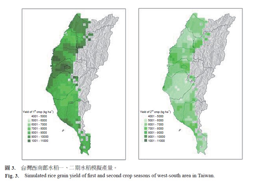
The purpose of this study was to setup an evaluation system for grain crop production in Taiwan. Take paddy rice production as an example, the system adopted DSSAT model and used weather, crops and soil databases for model simulation. The simulated outputs were used to evaluate the entire regional paddy rice productivity based on a 5 km × 5 km coordinate system with the aid of geography information system (GIS). The verification system to validate simulation outputs was also established. By using the evaluation system with various environmental conditions, it would provide valuable information for strategy planning to cope with climate change as well as to activate the reuse of fallow land.
Key words:Rice (Oryza sativa L.), Crop model, Geography information system (GIS), Climate change
Download:![]() PDF Links
PDF Links
Taiwan Agricultural Research
 Submit your manuscript
 Guide for authors
- 1. Development of Tractor-Mounted Seedling Transplanter for Sweet Potato
- 2. Synergistic Effect of Additional Gas on the Toxicity of Phosphine to Sitophilus oryzae and Sitophilus zeamais (Coleoptera: Dryophthoridae)
- 3. Effects of Temperature and Solar Radiation on Growth Traits and Plant Elements in Purple Leafy Sweet Potato