News

Investigation of Agricultural Land Resources

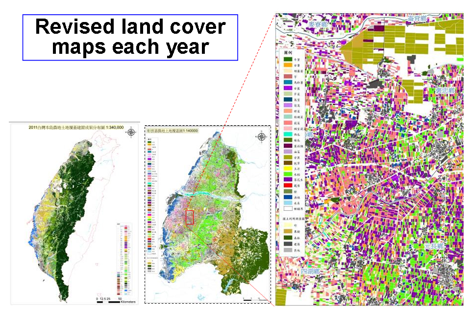
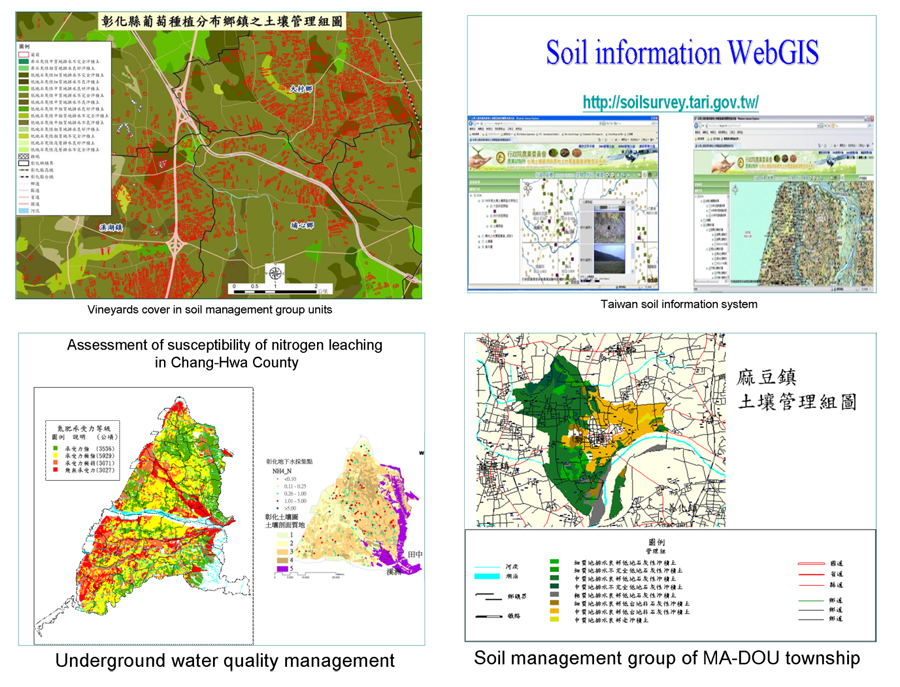
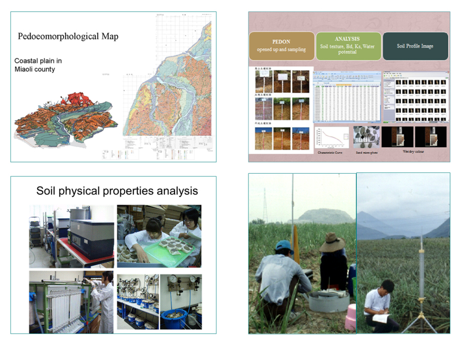
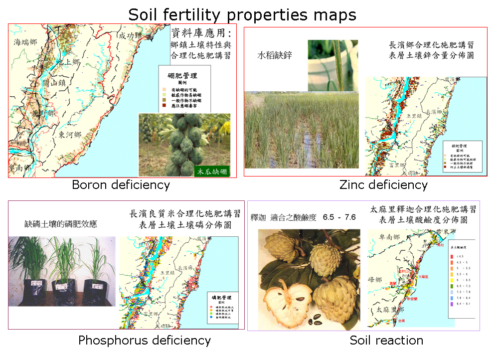
    The Taiwan Agricultural Research Institute (TARI) is the only organization that has implemented soil resource investigation tasks in Taiwan for more than 100 years. For many years, TARI produced several programs for specific soil surveys, soil mapping, and thematic map construction for soil interpretation and applied this soil information to various disciplines, such as paddy rice production, groundwater quality and arable land management, and soil liquefaction risk assessment.

  • The land cover database of Taiwan is based on remote sensing technology. It is expected that the entire island-wide farming area database can be completed in 2015 and updated 3 times per year. Information from the TARI website regarding the distribution pattern of crops can be used for decision making in agricultural and related natural resource management.
    Soil resource information systems have been applied in several fields, such as classification of the soil productivity in paddy fields, soil productivity promotion planning, soil management systems, assessments of soil liquefaction susceptibility, nitrogen-fertilizer-sensitive zones, potential soil heavy metal-polluted areas, and food safety, and soil carbon stock estimation.
    A novel soil survey program has been conducted since 2008. To fulfill a quantitative database requirement for NRM in the near future, the program applies numerous novel techniques, such as remote sensing, pedogeomorphological analysis, pedotransfer function approaches, and the measurement of soil physical properties, in both the field and the laboratory.
  • A 250 m × 250 m sampling grid soil fertility survey project was conducted from 1991 to 2007. Crucial indicators, including soil pH, organic C content, and the availability of macronutrients and micronutrients in the soil from the surface to a depth of 1.5, were analyzed to evaluate the soil quality changes and interpret the data for soil management, fertilizer recommendation, and food safety assessment. The soil data and maps can be retrieved from TARI.
    TARI has a world-class soil museum that exhibits the 4 major thematics of soil, including pedogenesis, soil classification and characteristics, and soil function and conservation. More than 50 soil monoliths with figures, multimedia, and models are exhibited, providing a detailed knowledge of soil.
    Taiwan Soil Museum
UPDATE:2015-06-24 16:15:00
  • BACK